
This blog took way longer than I imagined! In October, whilst I was looking at the driving route to Loch Muick (I want to walk around it at some point) on my trusty OS map I noticed just how many tiny little markers there were along the roads that indicated ‘places of interest’. I decided it would be a great idea to visit every one of those, probably underappreciated, sites all the way from Aberdeen to Balmoral. I thought that we (my partner and I) would be able to knock it out in a day. 12 places of interest, 1 day, blog ready in time for my November post. Fool! That was a bit optimistic, to put it lightly, especially with that quickly fading Autumn light. A lot of the sites were difficult to find and once we’d taken the time to locate them, we wanted to linger and enjoy them rather than hurry off. I’m glad we didn’t rush it.
So, with a few months delay I’m going to tell you a tiny bit about those sites! Most of them have tricky parking, as in you just need to find somewhere as safe as possible along the side of the road and just go for. I also think it helps having an OS map, whether that’s on your phone or a physical copy, because most of them are literally just dots on the landscape with no signage. I think that’s part of the fun though. Just seeing something marked on a map and exploring until you find it.
1. Binghill Stone Circle.
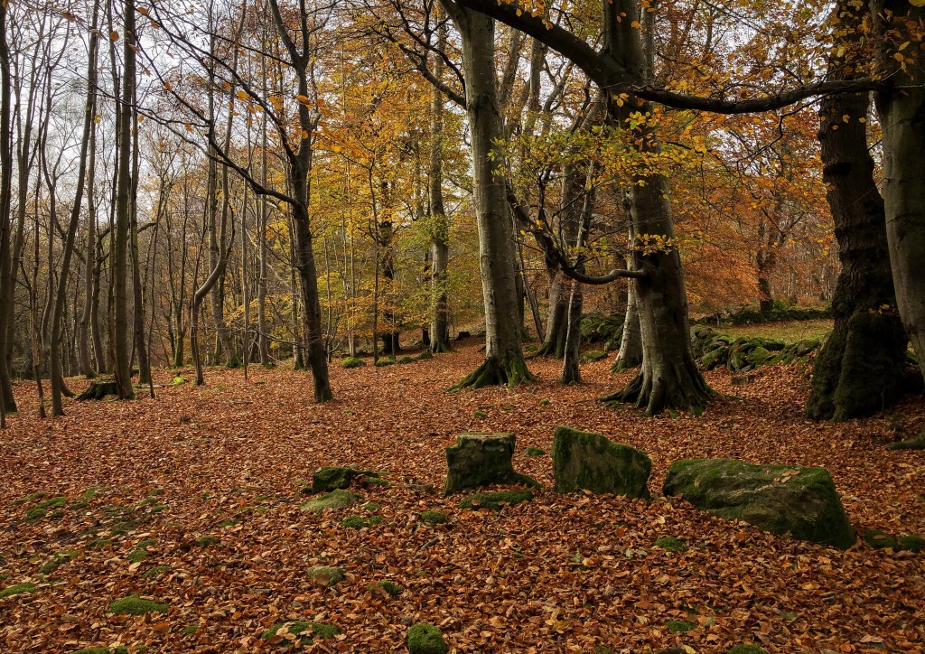
This was the first stop for us, and it was a great way to start. To find it we pulled over and parked out of the way on the side of the road near Milltimber woods on Contlaw Road, and then walked through some gates with ‘private property’ signs and asked for some help in locating the circle. We spoke to a super helpful chap who owned the land and he said he thought it was easier to park and access the circle from Binghill Road…something I’d definitely suggest trying if you want to check out this site. In terms of directions once you’re off the road all I can really say is walk uphill into the woods and search around the area marked as “Recumbent Stone Circle” on Google maps. You really just have to follow your gut instinct and have an explore.
Once you get there only 3 of the stones are still standing, including the recumbent, although some of the smaller kerb stones are also in their original position. By ‘recumbent’ I mean that it is, as the name suggests, lying down…on purpose! The recumbent is flanked by two tall stones and then the other stones follow around in a circle, graded in height. Apparently, these recumbent stone circles are unique to Aberdeenshire, in Scotland and Cork and Kerry, in Ireland. They’re not quite sure what these recumbent stone circles were used for, but they think they could have been used for ritual purposes related to the moon. By ‘they’, I guess I mean historians! This stone circle is dated as Neolithic/Bronze Age, so around 3000BC. It’s hard to fathom anything that long ago!
History aside, this place just feels magical. We sat here for quite a while just chatting about the past, wondering what things might have been like, how the land might have lain, where people could have lived, what relationships were like…just pure conjecture and wild imagining!
2. Park House Symbol Stone.
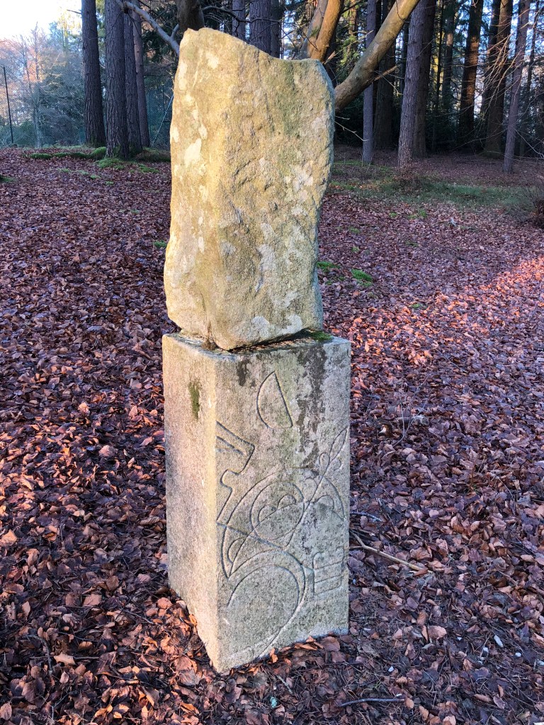
Hmm, this is an odd one. To start with, I still have no idea where you should park if you want to see this. I struggled to understand the access to the area (coming from England, I still sometimes struggle to understand access rights and I get scared). We ended up parking precariously off the side of the road and scrambling up a bank onto the Deeside Way, and then walking onto the Park House Estate. There must be better ways of doing this!
Anyway, at Park house is a Pictish symbol stone which is thought to be early Middle Ages (5th to 10th century AD). The symbol stone is actually sat on top of a replica (an apparently inaccurate replica). This shows what it ‘should’ have looked like in its heyday with a mirror and a double-sided comb, a notched flower, a crescent and a V-rod. I have no idea what that all means!
3. Gibbet Stone – Mill of Dess.
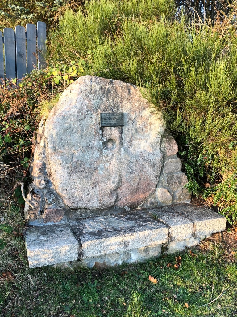
This large mill stone shaped stone is easy to see from the road, but I would have had a hard time guessing what it was before reading about it. For parking you just have to find some vaguely okay space on the side of the road to stop! The same goes for most of these sites. This gibbet stone is thought to be the place into which a gibbet tree was inserted. What’s a gibbet stone, gibbet tree or indeed gibbet I hear you ask? Well, there’s no nice way to put it, a gibbet is something you hang somebody from/in. Whether that’s as a punishment (i.e. displayed in a cage but not left to die), directly as a method of execution (hanging by the neck or starvation in said cage) or as a warning (by leaving or placing a body there until it fell down – you can imagine what a state that would’ve been). So, a gibbet stone was what you stuck or fixed the gibbet tree/gibbet into. Gibbets or gibbet trees didn’t always require a stone, but it was thought that this particular gibbet stone was placed and used on the nearby Gallows Hillock.
I’m a fan of dark history so I was looking forward to seeing this one!
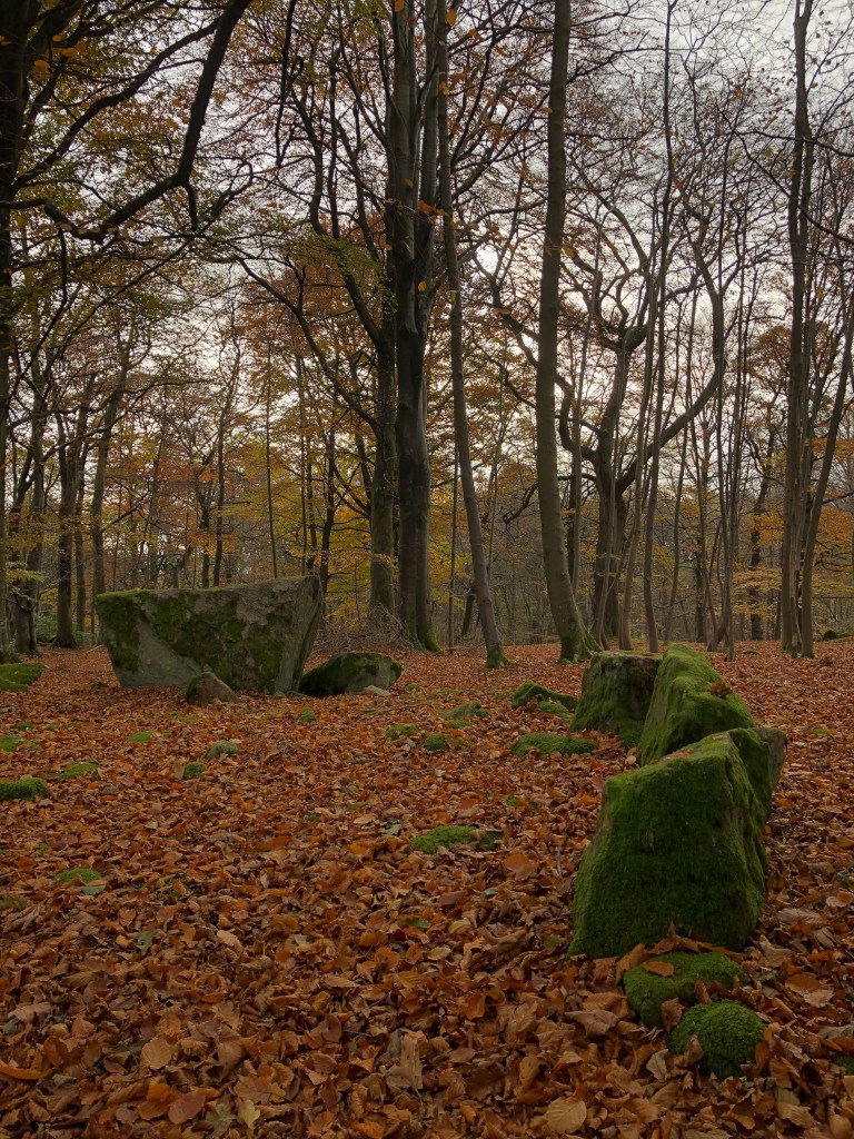
4. Aboyne Stone Circle.


This was one of the sites we spent the most time trying to locate, and then once we found it we wondered why it ever took so long! Parking in Aboyne is easy as it actually has carparks and safe places to pull over. Wherever you stop in Aboyne (it isn’t big), the stone circle is easily reached after walking past one of the local cemeteries (possibly belonging to St Margaret’s) and up the main path through the woods. On google maps the street is called ‘Aboyne Stone Circle’ and I think there is a sign directing you vaguely the right way, so it’s not totally hidden. At some point there’s a track that trails off left (North West) into the woods and the stone circle sits not far away from a field. If you’ve reached a farm gate on the main path then you’ve gone a bit too far, but head left (West) into the woods from that point and you should be alright. I appreciate it’s a fairly poor description, but it’s better than what we had!
The circle, once you find it, is very, very small at about 2.5 metres wide. This alone makes it pretty interesting. Apparently one of the stones, although firmly situated, might not be in it’s original place. My incredibly untrained eye couldn’t tell you which one though! The circle is dated somewhere in the Bronze Age (2200 BC – 800 BC) and the thoughts are that it could be a four poster stone circle. I’ve just learned that means there are four (or sometimes more) upright stones in an irregular quadrilateral. The circle is either this or a transition from a four poster circle to something else!
5. “Stone”!

So, this one outfoxed us for far too long! On the map it’s just a black dot that has ‘stone’ written next to it and I was therefore convinced it must be a standing stone. It’s marked as being right on the side of the road, so every time we drove through the area I’d peer intensely out of the window looking for it, but I never caught sight of it. Anyway, it came time to stop and look for it, so we stopped at the pull in next to the big ‘YOU ARE NOW IN THE HIGHLANDS’ sign. We walked up and down the road several times, scrubbed about in the bushes and even asked a lady coming out of her house, but we couldn’t find it. She said that her mother was interested in local history and had never mentioned a standing stone nearby. Eventually, it dawned on me that the ‘YOU ARE NOW IN THE HIGHLANDS’ sign is the stone marked on the map!
6. Loch Kinord Crannog, Castle and Castle.

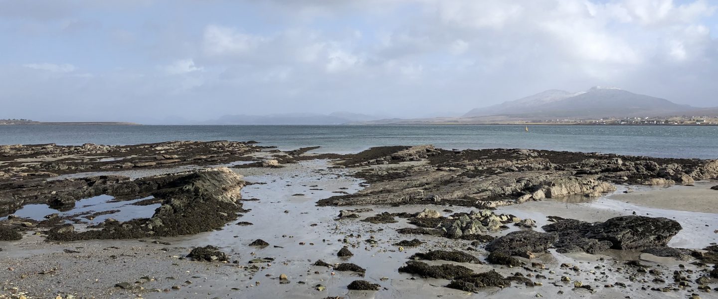
So, this is a little off the direct Aberdeen to Balmoral road but I counted it as part of my route because I can do what I want! Plus, it’s a nice walk around Loch Kinord. There are 3 historical things of note there. Firstly, the crannog. A crannog is a manmade island constructed from wood (and presumably other bits) and this one was built around 2500 years ago. There would have once been a hut on top of the island but now it’s just the island itself, and you would 100% think it was natural. Secondly, is Kinord Castle. Okay, there’s no castle there anymore, just another island…but, you can imagine! Kinord Castle was burned down in the 1600s but as far as I know it had stood for about 600 years up to that point! Thirdly, and finally, is the Kinord Cross. Kinord Cross is a kite-shaped pink granite stone with an elaborate cross carved into it. This Christian monument was made sometime in the 9th century. It was moved to Aboyne Castle in the 19th century and then finally moved back to the loch in the mid-1900s.
I can’t imagine any of these sites will change your life but, as I say, it’s a nice walk around Loch Kinord.
7. Tullich Church and Souterrain.


Tullich Church is a great place to park for the souterrain, and it’s worth checking out too. This is a ruined medieval church (built on the site of an even older church) and it has a collection of very cool Christian and Pictish stones held safely behind glass. There’s a great information board all about the stones so I’ll let that do the talking if you decide to visit.
We actually visited for the souterrain though (not the church) and found it on our last trip along this route. I kept putting it off because there were always cows in the field and I’m super wary (read scared) of cows! Luckily on the last visit there were no cows around and we strode confidently across the field to a rocky/scrubby area and located the souterrain. Unfortunately, you can no longer get inside but we shone torches into the cavities and imagined what life was like around 0 AD when this was thought to date back to! The souterrain is an underground space, but it’s not really known what they were used for. Storage for grains? A place to hide? Or a bit of both? What do you think?
If you want to visit a really cool souterrain that you can crawl inside, I definitely recommend the Culsh earth house near Tarland.
8. Abergain Castle


I wasn’t expecting much from this ruined castle but this was definitely a hidden gem! We pulled off the ‘main’ road and parked on the side of a farm access road (out of the way of farm traffic) and then walked across some sheep fields and up into the woods. Abergairn is what remains of a small tower house built in the early 1600s and because of its small stature it was thought to be a hunting lodge. It’s a stunning area. We went whilst the Autumn colours were at their peak, which definitely made everything look beautiful, but there was a stillness and peace there that made you want to linger for as long as possible.
9. St Manir’s Standing Stone.

To visit this stone there’s a super handy forestry commission carpark just down the road. From the parking area you just need to hop over a stream and a fence and then you’re at the standing stone. A very mini adventure! As well as the stone this is also apparently the site of a burial ground and a church but little/no evidence of that remains to someone like me (i.e. not an archaeologist). Apparently, the 6th century chapel that used to be situated here used this standing stone as a reading desk and much later, unbaptised children were buried here up until the 19th century.
In the comments section of a random Aberdeenshire history post I also read that from this standing stone you can see the hill on which the last Deeside witch was burned. I have no evidence to back this up, but I choose to believe it! That’s my ethos for many a historical tale!
10. Abergeldie Castle.
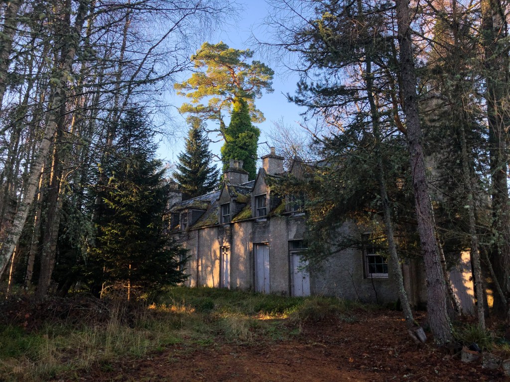

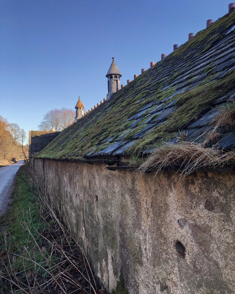
Abergeldie Castle is a 16th century tower house which prompted me to enter the lottery more regularly. I spent the whole time walking around this area deciding which bit I’d turn into an Airbnb or a granny flat for my parents, what I’d plant where, where I’d put the barbeque, what I’d use the pit prison for etc… (Probably wine to be fair). Not long after we got back from our day trip I asked Twitter whether anybody knew the status of this house. There were lots of incredibly old private signs that made it seem like it probably wasn’t private anymore, all gates were open, no lights were on, nobody was around and everything looked very unloved. But, on the other hand, we felt like we were trespassing, there were enough possessions (like work jackets and spades) still around that we felt somebody could have lived there recently or perhaps be thinking about renovating and it definitely had been very loved at some point. It was all a bit mysterious. Anyway, it turns out that the man that had lived there had moved into an old people’s home many years prior and had recently passed away. Which is all a bit sad. It is a really beautiful spot and whoever gets to live there next is incredibly lucky…and wealthy!
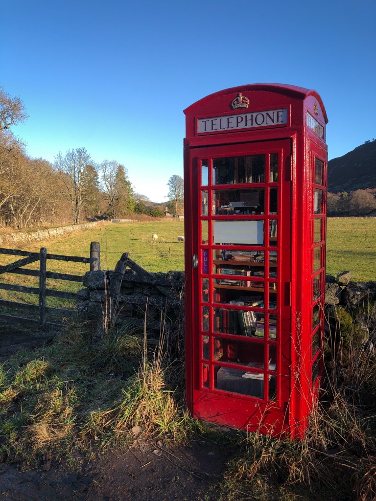
To get to this castle we parked by the red phone booth/book swap just down the road, which is worth stopping at anyway.
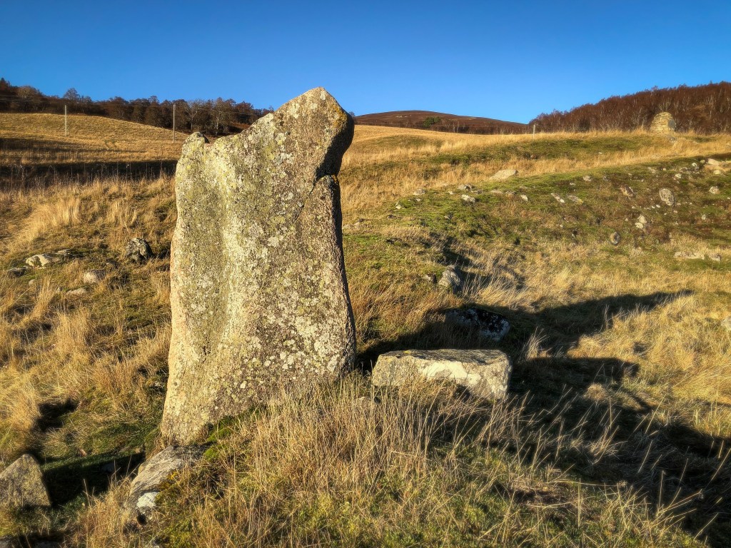
11. Scurriestone.


This is an easy one to get to. We just parked at a little pull in and then walked into the field where the stone stands. Apparently, it’s thought to mark the spot where “the road diverged to the fords of the Dee and the Muick”, but that’s a little tricky to imagine now. It’s just listed as prehistoric which spans a large wedge of time…basically, it’s very old.
12. Knock Castle.

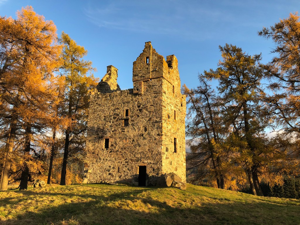
I think this is now amongst my favourite castles in Aberdeenshire. Knock sits on top of a hill surrounded by larches and it unquestionably pretty.
Knock is a 16th century tower house, which is full of tragedy. It was owned by the Gordons who had beef with a neighbouring clan, the Forbes. One of the Gordon’s, Henry, was killed by the Forbes clan so the castle went to Gordon’s son, Alexander. At some point Alexander’s son secretly married a Forbes girl, which as you can imagine did not go down well. The father of this girl had Alexander and 7 of his brothers killed whilst they were digging peat. I think there’s some chat about how they were armed and digging peat on Forbes land at the time (so not wholly innocent) but, after this long it’s probably hard to know the ins and outs of it. Anyway, the brothers (including Alexander) were then beheaded and their heads were spiked on top of their spades. Charming! On hearing this news Alexander fell to his death down the Knock Castle stairs and apparently his miserable and tormented ghost still haunts the ruins. The Forbes did not get away with this scot free however, and the head of the Forbes clan was executed by the law, his lands were also taken away and given to Abergeldie.
To get to Knock Castle we parked off the road at a quiet junction and just walked up to it, but I saw that other people had driven much closer to the castle and just parked in the middle of the road! It’s another one of those places where you just have to find a spot that looks acceptable and go for it!

I think if I can conclude anything from this series of excursions between Aberdeen and Balmoral it’s that this county is just packed with history. You can barely move without tripping over some ancient site and because of that I imagine there’s something for everyone. Unfortunately, however, there’s often not a lot of easily available information on most of these places and you end up trawling random sites with numerous search terms just to find a golden nugget of information. But, maybe that’s part of the fun, I guess not everything should be easy and I don’t necessarily think you need to know exactly what you’re looking at to enjoy it. Two of the best websites in terms of standing stones, circles and souterrains were https://www.megalithic.co.uk/ and https://www.canmore.org.uk/ if you’re ever interested in finding out about anything in your area.
Happy exploring!

One thought on “Hidden Gems: Aberdeen to Balmoral in Historical Sites.”